Precision 3D Documentation for AEC Projects
Transforming spaces into accurate digital models for informed design and construction

Service Overview
Our cutting-edge 3D scanning and LiDAR technology provides precise as-built documentation for architecture, engineering, and construction projects. We deliver accurate existing conditions drawings that form the foundation for successful design, renovation, and construction endeavors.

2D CAD Drawings
Accurate digital floor plans and elevations created using computer-aided design software. Includes precise measurements, architectural symbols, and layered information for detailed property visualization and construction planning.
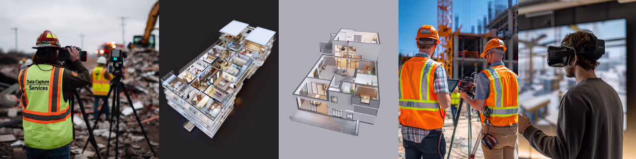
3D BIM Models
Comprehensive Building Information Models containing detailed 3D representations of the property. Incorporates architectural, structural, and MEP data for enhanced visualization, analysis, and project coordination across disciplines.


Point Cloud Data
Raw, high-density 3D scan data comprising millions of measured points. Captures precise spatial information of the entire property, serving as a foundation for various analyses, modeling tasks, and future reference.
Key Benefits
Reduce on-site measurement time by up to 80%
Minimize errors and rework with millimeter-accurate 3D models
Enhance collaboration among project stakeholders
Technology Used
We use the best technology to provide the best services


Matterport Pro3
Advanced 3D camera system creating immersive virtual tours. Captures high-resolution imagery and depth data for realistic digital twins.

Matterport Software
Matterport software processes data from 360-degree cameras to create immersive 3D virtual tours and interactive models, ideal for real estate, property management, and virtual walkthroughs

iGUIDE
Advanced property documentation system. Provides accurate floor plans and 3D virtual tours. Enables detailed spatial analysis and efficient property management.
FAQs
Get answers to common questions about our 3D documentation services for AEC projects.
We provide deliverables in industry-standard formats including DWG for CAD drawings, RVT for Revit models, and various point cloud formats (e.g., RCP, E57, PTS) compatible with most 3D software.
Project duration varies based on size and complexity. A small building might take 1-2 days for scanning and 3-5 days for processing, while larger projects can take several weeks.
3D scanning provides accurate as-built documentation, revealing hidden issues and allowing for precise planning. This reduces errors, minimizes rework, and can lead to significant cost savings.
Absolutely. We provide BIM-ready models that can be easily integrated into popular BIM software like Revit, ArchiCAD, or Recap.
Yes, our scanning equipment is non-invasive and does not emit harmful radiation. It's safe for use in most environments, including hospitals and historic buildings.
Yes, we provide comprehensive documentation of both interior and exterior spaces, including aerial imagery for larger properties.
Our 3D scanning technology provides measurements accurate to within a few millimeters, far surpassing traditional measuring methods.