3D Documentation for Emergency Restoration
Swift, accurate capture of damaged properties for efficient restoration planning

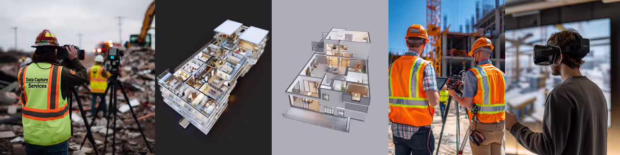
Service Overview
Our Emergency Restoration Documentation service provides rapid 3D scanning and digital documentation of damaged properties. Using state-of-the-art technology, we capture precise as-is conditions to support insurance claims, guide restoration efforts, and expedite the recovery process.

2D Floor Plans
Accurate, to-scale layouts of the property highlighting damaged sections. Includes room dimensions, structural elements, and annotations detailing the extent and type of damage for efficient restoration planning.

Virtual Tours
Immersive digital walkthroughs allowing remote exploration of damaged areas. Features high-resolution imagery and interactive hotspots, enabling detailed assessment and planning without physical presence on-site.
Key Benefits
Detailed 3D scans of all affected areas
Support faster insurance processing with accurate data
Enable efficient restoration with exact measurements
Technology Used
We use the best technology to provide the best services

Leica BLK360
Compact, high-precision 3D imaging laser scanner. Captures detailed point clouds and panoramic images for accurate spatial data collection.

Matterport Pro3
Advanced 3D camera system creating immersive virtual tours. Captures high-resolution imagery and depth data for realistic digital twins.

iGUIDE
Advanced property documentation system. Provides accurate floor plans and 3D virtual tours. Enables detailed spatial analysis and efficient property management.
FAQs
Get answers to common questions about our 3D documentation services for AEC projects.
Yes, we provide comprehensive documentation of both interior and exterior spaces, including aerial imagery for larger properties.
Our 3D scanning technology provides measurements accurate to within a few millimeters, far surpassing traditional measuring methods.
Yes, our detailed documentation is often used for legal documentation, insurance claims, and property valuations.
Xactimate and 2D Schematic Floor Plans, (.ESX, .SKX, .PNG, .PDF)
We aim to be on-site within 2-4 hours for local emergencies, and within 24 hours for most locations nationwide.
Our detailed 3D documentation provides comprehensive evidence of damage, supporting faster and more accurate insurance claim processing.
Yes, we offer continued support, including additional scans and documentation updates as restoration progresses.
Absolutely. Our deliverables are compatible with most restoration and project management platforms.
Yes, our team is trained for various hazardous conditions and uses equipment suitable for unstable environments when necessary.
Experience precision in every project.